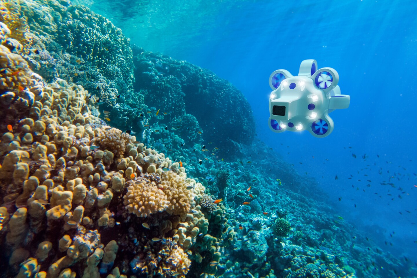
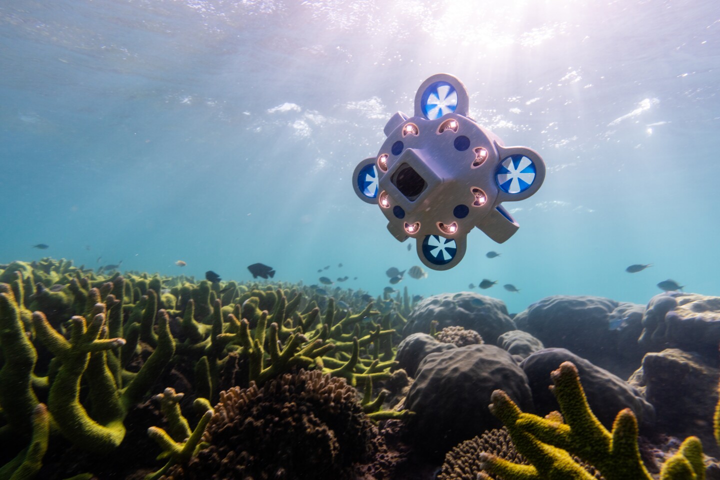
While AUVs (autonomous underwater vehicles) are invaluable for gathering oceanographic data, they also tend to be fairly large and very expensive. The Hydrus offers a much smaller, less costly alternative, which still packs a lot of punch.
Most AUVs are torpedo-shaped robotic watercraft that can autonomously explore the undersea world for days at a time, utilizing a suite of sensors to record video and other forms of data as they do so. They’re typically big enough that they have to be launched and retrieved using cranes on relatively large surface vessels.
Renting or buying such a boat – along with paying its crew – can be quite expensive. Additionally, depending on the make and model, the AUVs themselves may cost several million dollars. That’s where the Hydrus is designed to come in.
Manufactured by Australian company Advanced Navigation, it measures just 470 by 260 by 260 mm (18.5 by 10.2 by 10.2 in), weighs 6.7 kg (14.8 lb), and should sell for around US$50,000. Its small size means that it can be carried on a commercial airliner as luggage, and deployed by just one person from a small boat.
Utilizing seven hubless electric thrusters, it can travel at a top speed of 4 knots (7 km/h or 4.6 mph), dive to a maximum depth of 3,000 m (9,843 ft), and travel up to 9 km (5.6 miles) from its launch point. One charge of its lithium battery should be good for about three hours of runtime. Its camera shoots 4K/60fps video, aided by eight LED spotlights which put out a combined 20,000 lumens.

Advanced Navigation
Users start by programming in a route for the Hydrus to follow. The AUV proceeds to keep track of where it is on that route, via several technologies.
First of all, while the Hydrus is still on the surface and able to access GPS satellites, it makes note of its launch point’s GPS coordinates. Once submerged, it uses onboard accelerometers and gyroscopes to track the speed and direction in which it travels away from that location. The AUV is aided in this regard by a sonar system, which it utilizes to monitor the speed and direction in which it’s traveling over the seabed.
Additionally, the Hydrus uses what is known as an ultra-short baseline (USBL) positioning system.
In this setup, an underwater acoustic transducer on the surface vessel sends acoustic “pings” through the water, which the AUV receives and pings/replies back to using a transponder of its own. By analyzing the amount of time that elapsed between the first ping being sent and the reply ping being received – and the direction from which the reply came – it’s possible to determine the Hydrus’ present position. That data is sent back to the AUV in subsequent pings, allowing it to know where it is relative to the pre-programmed waypoints on its route.
It should be noted that while the USBL system can be used to alter the Hydrus’ route if necessary, the craft can’t be remotely piloted in real time.

Advanced Navigation
Video and other data – including water conductivity, temperature and depth – is recorded on an onboard hard drive for post-mission retrieval. That said, the Hydrus can also use an integrated optical modem to transmit real-time data through the water to a receptor on its host vessel, in the form of rapid pulses of light – the maximum range for this type of communication is about 10 m (33 ft).
Possible applications for the Hydrus include ecological surveys, 3D mapping of the sea floor (via the sonar system), plus the underwater inspection of aquaculture facilities and offshore wind farms.
“The fact that it’s got acoustics, it’s got a camera, it’s got inertials, it’s got flight-safe batteries … all of that tech into one is a very big achievement,” Advanced Navigations’ subsea product manager Peter Baker told us. “It’s got all the technology you’d expect in a much, much larger, more complex system.”
The Hydrus should be commercially available by the fourth quarter of this year. In the meantime, you can see it in action in the video below.
Hydrus, The Drone Revolution Underwater
Source: Advanced Navigation
Source of Article