Nigeria is breaking new ground in West Africa by hosting the region’s first geospatial intelligence (GEOINT) training for Customs officers, marking a milestone in the continent’s fight against cross-border crime and smuggling through advanced technology.
The week-long World Customs Organization (WCO) Expert Master Trainer Programme on Geospatial Intelligence, which began June 2 in Abuja, brings together customs officials from across West Africa to equip them with cutting-edge tools—satellite mapping, location analytics, and real-time spatial data—to monitor borders and disrupt illicit trade routes.
The initiative, powered by the WCO in partnership with the Japan International Cooperation Agency (JICA), positions Nigeria at the forefront of regional border management transformation, with implications for security, trade facilitation, and transnational crime deterrence.

As global trade grows increasingly complex, criminal syndicates are also evolving, he warns. “The complexities of the modern supply chain, coupled with the sophistication of criminal methods across multiple jurisdictions, demand equally sophisticated response mechanisms.”
Geospatial intelligence: Nigeria hosts regional border tech masterclass
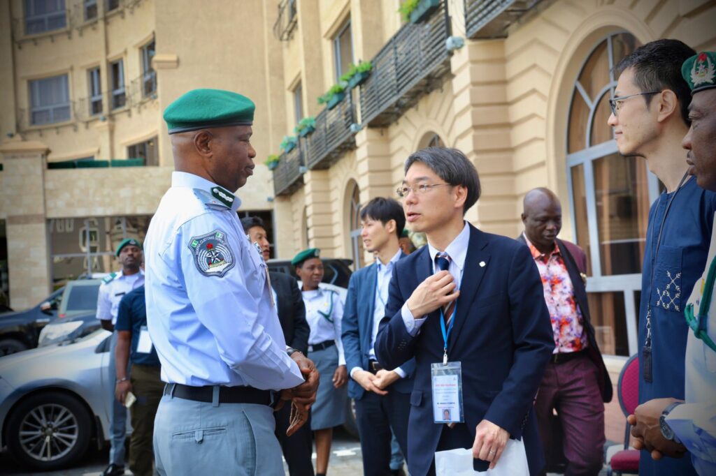
Bashir Adewale Adeniyi, Comptroller-General of Customs, says the GEOINT programme reflects years of deliberate investment in innovation and partnerships.
“What we are witnessing today is the fruition of nearly a decade of sustained collaboration, innovation, and capacity building,” Adeniyi says in a statement. “I wish to commend both WCO and JICA for providing us with the opportunity to emerge as one of the leading Customs administrations in fostering GEOINT capacity within our region.”
The Customs chief underscores Nigeria’s new regional leadership role in high-tech border surveillance. “This recognition comes with both pride and responsibility, as we continue to serve as a model for other Customs administrations seeking to enhance their border management capabilities.”
As global trade grows increasingly complex, criminal syndicates are also evolving, he warns. “The complexities of the modern supply chain, coupled with the sophistication of criminal methods across multiple jurisdictions, demand equally sophisticated response mechanisms.”

Japan and WCO back Nigeria’s border innovation push
WCO representative Motohiro Fujimitsu hails the GEOINT training as a “game-changer” for fragile borders in West Africa, while Yuzurio Susumu, JICA’s Chief Representative in Nigeria, reaffirms Japan’s commitment to supporting African nations build “resilient and modern border control systems through geospatial intelligence.”
The initiative aligns with JICA’s broader Official Development Assistance (ODA) strategy, which has supported similar capacity-building programmes across the continent to promote peace, development, and rule of law through smart technologies.
Dera Nnadi, Assistant Comptroller-General of Customs and Head of the Strategic Research and Policy Department, delivers a vote of thanks, urging participants to fully engage with the training and return as change agents to secure their national frontiers.

Geospatial intelligence uses satellite imagery, spatial data, and machine learning analytics to provide situational awareness of people, goods, and movements across borders. This tech-driven surveillance capability enables Customs authorities to proactively detect smuggling, manage risk, and enforce trade compliance in real time.
Regional roadmap: From Côte d’Ivoire to Nigeria
The Abuja masterclass builds on the WCO’s pilot geospatial intelligence workshop held from September 2–12, 2024, in Abidjan, Côte d’Ivoire. That session introduced officers from Nigeria, Ghana, Togo, Benin, and Côte d’Ivoire to Geographic Information Systems (GIS) as tools for developing GEOINT solutions in fragile border environments.
According to the WCO, “The principal aim of the workshop was to provide the participating WCO Members with the knowledge required to produce GEOINT,” under its Fragile Borders Action Plan, supported by the German-funded West Africa Security Project (WASP) and the WCO/JICA Joint Project.
Participants undergo two weeks of hands-on instruction—starting with advanced GIS methods and progressing into operational GEOINT planning. The training uses real-world border scenarios and simulations supported by private sector experts and WCO trainers.
Why GEOINT matters for Nigeria and West Africa
Geospatial intelligence uses satellite imagery, spatial data, and machine learning analytics to provide situational awareness of people, goods, and movements across borders. This tech-driven surveillance capability enables Customs authorities to proactively detect smuggling, manage risk, and enforce trade compliance in real time.
For Nigeria, the GEOINT programme represents more than just a training milestone—it signals a decisive move toward tech-empowered border governance and national security resilience. As transnational threats evolve, so must the tools to counter them, according to the Nigeria Customs.
Source of Article