As scientists sharpen their observational tools and more data comes to light, our view of the changes gripping our planet is only becoming clearer, and it’s not a pretty sight. A striking new example of this has come from glaciologists studying the seasonal growth and loss of the Greenland Ice Sheet, who have concluded that even if we completely stopped burning fossil fuels today, it would shed enough mass on its own to cause global sea levels to rise by almost a foot, at a minimum.
Just as the Greenland Ice Sheet experiences melting in warmer weather, the colder months cause snow resting on top to turn into ice. In a stable climate, this process would play out in equilibrium, with the mass lost over summer regained during the winter. But with the planet growing hotter due to climate change, things are becoming increasing off balance.
To understand how this melting ice will impact sea levels around the world, scientists use computer models of ice flow and complex climate interactions. According to the authors of this new study, this approach has shortcomings in that they are imprecise and don’t account for a number of factors scientists are observing in the field. These include more rain that is accelerating the melting of surface ice, an influx of tropical ocean currents into Greenland’s fjords, and the darkening of the sheet surface that causes it to absorb more heat.
“We’re observing many emerging processes that the models don’t account for that increase the ice sheet’s vulnerability,” study author Alun Hubbard, Professor of Glaciology at University of Tromsø, writes in an accompanying piece for The Conversation.
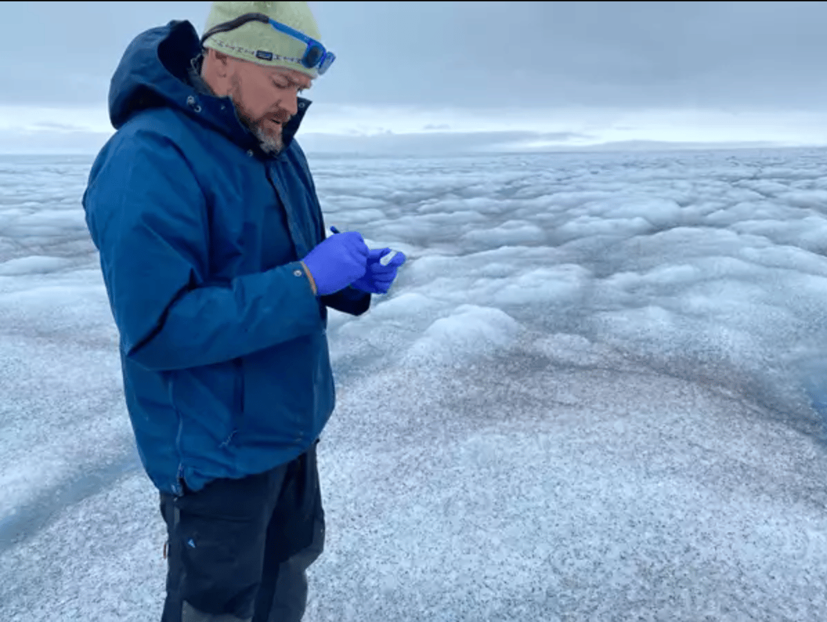
Hubbard and his colleagues have taken a different approach, and one that sidesteps computer models completely. The study is built on two decades of measurements from weather stations, satellite data on bare ice and surface mass, and a glaciological analysis technique known as volume-area power law scaling.
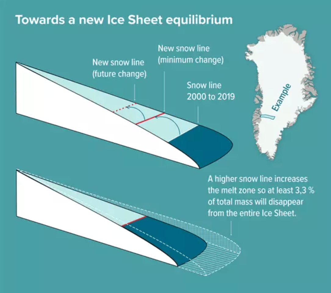
The team made assessments on the changing climate in the Arctic between 2000 and 2019, and how this is contributing to the imbalance in the ice sheet’s losses and gains each year. They did this by focusing on the shifting snow line, the boundary between the areas of the Greenland Ice Sheet that are subjected to melting in the summer and those that are not. A particularly warm summer might drive this snow line to higher elevations, exposing more ice to melting conditions, while a colder winter might bring it back down again.
The Geological Survey of Denmark and Greenland, GEUS
The scientists found that Greenland’s ice sheet is now in such a state of disequilibrium, and has become so out of tune with the Arctic climate, that it won’t be able to sustain its mass. For the physics to add up, the sheet is now destined to correct itself by shedding a further 3.3 percent of its volume. That’s even if the world stopped burning fossil fuels today. This equates to 110 quadrillion tonnes of ice, enough to drive up average global sea levels by at least 27 cm (10 in).
“It is a very conservative rock-bottom minimum. Realistically, we will see this figure more than double within this century,” said lead author Jason Box, from the National Geological Survey of Denmark and Greenland. “In the foreseeable scenario that global warming will only continue, the contribution of the Greenland Ice Sheet to sea level rise will only continue increasing. When we take the extreme melt year 2012 and take it as a hypothetical average constant climate later this century, the committed mass loss from the Greenland Ice Sheet more than doubles to 78 cm (30 in).”
According to the US National Ocean and Atmospheric Administration (NOAA), global sea levels have risen by 8-9 inches (21-24 cm) since 1880, and the rate of level rise is only accelerating. The idea that Greenland alone is already expected to contribute more than this, likely by the end of the century according to the study authors, is an ominous sign.
Rising sea levels are expected to bring a host of new dangers to coastal communities around the world. These include shoreline erosion, risks to wildlife and damage to infrastructure, from bridges to beachfront apartments. Higher background water levels would mean that destructive storm surges make their way further inland, while flooding would become far more frequent. According to NOAA, high-tide flooding along much of the US coastline is already 300-900% more frequent than it was just 50 years ago.
As we saw in another study this month highlighting the accelerated warming taking place in the Arctic, modern satellite data continues to shed important new light on the effects of climate change. In this case, the study authors see their new approach as a valuable way of filling in important blanks created by imperfect modeling.
“The ice flow models are not ready in this area,” said Box. “This is a complimentary way of calculating mass loss that has been lacking.”
The research was published in the journal Nature Climate Change.
Source: National Geological Survey of Denmark and Greenland
Source of Article