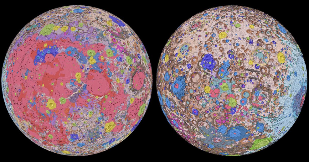
Drawing on data from satellites and Apollo-era missions, scientists at the US Geological Survey (USGS), NASA and the Lunar Planetary Institute have pieced together what they say is the first comprehensive geological map of the Moon.
Our 4.5-billion-year-old satellite is adorned with all kinds of rocks, craters and other interesting geological features. To dig into the details, the scientists looked to regional maps from six Apollo missions and combined these with modern data from recent satellite missions.
Refreshing the historical maps with fresh scientific observations enabled the scientists to put together an incredibly detailed perspective of the Moon, showing its geology at a scale of 1:5,000,000.
“People have always been fascinated by the Moon and when we might return,” says current USGS Director and former NASA astronaut Jim Reilly. “So, it’s wonderful to see USGS create a resource that can help NASA with their planning for future missions.”
The scientists say this Unified Geologic Map of the Moon can act as a blueprint for future manned missions to the Moon, as well as offering key insights for scientists here on the ground.
“This map is a culmination of a decades-long project,” said Corey Fortezzo, USGS geologist and lead author. “It provides vital information for new scientific studies by connecting the exploration of specific sites on the Moon with the rest of the lunar surface.”
A high-res video animation can be viewed here and a high-res version of the map can be found here.
Source: US Geological Survey
Source of Article